Blue lines, brown lines and mountain tracks

For many millenniums rivers have flowed downhill and for not quite as long a period man has mapped these rivers. By using blue lines to mark the channel and brown lines spaced at increments of a specified height he was able to show not only the rivers path, but also the gradient at which it fell. Kayakers have used these line drawings to seek out rivers to float their boats up on, but many now rely on printed literature to tell them where to go and boat.
My little excursion into Scotland tried to get away from the use of the guidebook and instead return to basics so that a proper adventure could be had. The idea had been proven before by the guys I was boating with, and it was proven once again.
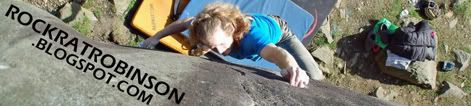
 Hiking in on a mountain trail.
 In the upper section of the river.
 Running the shizzle.
 The river was only half of it: the location was the other half.
 Inspection, inspection, inspection was the name of the game.
 Putting it all together.
 Good times.
Good lines, stay safe and see you on the wet stuff...
Iain
![]()

No comments:
Post a Comment